 Geek Prepper Survival Skills when SHTF!
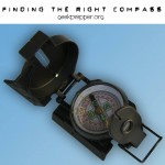
 Are one of those people, who can’t tell which way is north, without a compass? Then it’s time to develop your direction finding skills! Here are some handy, simple methods to determine direction!
Methods to Determine Direction
Sun
On Earth, the Sun rises in the East and sets in the West.
You can use this knowledge to help you find direction!
Shadow
- Stick a stick or branch into the ground
- Put a rock, or other marker, on the tip of the shadow, cast by the stick.
- Wait
- In a while (15 minutes or more) the Shadow will have moved. Draw a line between the rock, or other marker, and the current tip of the shadow. That line points East and West. The Rock, or first marker indicates West and the current tip of the shadow indicates East.
Wrist Watch
You can use your watch to determine direction. These are the direction, for those of us, in the Northern Hemisphere! If you are in the Southern Hemisphere, then your half-way point will be pointing North instead of South!
- Find the sun. If you look up and see a flaming ball in the sky, this could be the sun
- Point the hour hand (the little hand), on your watch at the sun.
- Locate the half-way point between the hour hand and 12.
- That half-way point will be pointing South.

Even if you only have a digital watch, you can still use this same method. Just imagine where the hour hand would be if you this was an analog watch, then follow the same procedure.
North Star
Polaris, the North Star, Sits above the North Pole. In the Northern Hemisphere, it can be located using the Big Dipper Constellation.
- Locate the Big Dipper
- Mentally Draw an imaginary line through the 2 outer stars that make up the “bowl” or “cup” of the Dipper. (These 2 Stars are named Merak and Dubhe)
- Follow this imaginary line straight (about 5 times the distance between Merak and Dubhe)
- Bang! There’s the North Star, Polaris!

Even if you are one of the lucky people, who has an internal compass, congratulations, make sure you don’t grow complacent. Navigation and direction finding are skills you must constantly use, or you may lose them!
Maps (like the Delorme Atlas Gazetteer), Compasses and GPS are great tools to have and to know how to use, but what if you don’t have them, when you really need them?


I love number one on determining direction with your watch…”Find the sun. If you look up and see a flaming ball in the sky, this could be the sun…” A calm funny… ;-)
Copyright © GeekPrepper.org Read more at: http://www.geekprepper.org/methods-to-determine-direction/
I was running a course on field craft a number of years ago and in a test asked trainees to detail a way to determin direction using a watch. One answer was that you tie a piece of string to the watch, swing it around your head until its going real fast then let go the string. Your watch is said to have gone west!